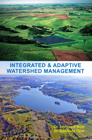

Integrated & Adaptive Watershed Management
The book “Integrated and Adaptive Watershed Management” describes the Watershed management in Ansupa lake catchment by using Remote Sensing and GIS technology, analyze the morphometric analysis, socio-economic condition and applied various survey technique for analyzing the relationship between the community and watershed program. The Ansupa lake is a hotspot of biodiversity and one of the largest freshwater wetland of Odisha. The book is distributed into seven chapters. Conservation of natural resources is a global concern for the whole world. Land and water are important resources, conservation, and use is a very important factor.
For conservation of those resources, watershed management is the best technique which included the participatory approach of the community. Landuse/land cover change has become a central component in current strategies for managing natural resources and monitoring environmental changes. Wetland conservation is also the main focus of this study. Many wetlands should be conserved which directly or indirectly involved with the community and their livelihood.
Remote Sensing (RS) and Geographic Information Systems (GIS) techniques provide effective tools for analyzing the watershed management and site suitability for adaptive measures of the region as well as for monitoring, mapping, and management of natural resources
About the Author: Dr. Jajnaseni Rout, working as GIS Analyst in Chilika Development Authority, Odisha. She has more than 12 years of experience in Research. She has many papers to her credit in national and international journals and also one book published as the second author. Her area of specialization is Cartography, Remote Sensing (RS), Geographical Information System (GIS), Watershed Management, Rural Development, and Coastal Management. She has expertise in RS and GIS software. She has participated in many National and International seminar and conference. She has participated in many national and international training programs related to her research areas.
Dr. Adikanda Ojha, working as a GIS Analyst in SPMU-ICZMP, Odisha. He has more than 13 years of experience in Research. He has 23 papers to his credit in national and international journals and also one book published as the first author. His area of specialization is Cartography, Remote Sensing (RS), Geographical Information System (GIS), Watershed Management, Rural Development, and Coastal Management. He has expertise in using RS and GIS software and scientific instruments. He has participated in many National and International seminar and conference. He has participated in many national and international training programs related to his research areas. He also invited as Resource Person in the capacity building program of many NGOs.
- Paperback: 206 pages
- Publisher: White Falcon Publishing; 1 edition (2018)
- Author: Karan Sharma
- ISBN-13: 9781947293915
- Product Dimensions: 12.7 x 1 x 20.3 cm
Indian Edition available on:


We Also Recommend